
Many times during the last ice age catastrophic floods unleashed by failing ice dams that created Lake Missoula in Montana raged across central Washington in waves 700’ high, scouring out canyons, redirecting rivers, creating huge scablands and moving huge Rocky Mountain boulders hundreds of miles west, some into the upper Willamette Valley in Oregon.
J. Harlen Bretz, a Washington native and University of Chicago geology professor had found evidence of massive floods across central Washington but was ridiculed by his profession, first because conventional wisdom, in reaction to Biblical “explanations” and overwhelming evidence of the slow pace of geologic change, resisted explanation by cataclysm, and second because Bretz couldn’t explain where the massive sources of water could have come from.
He made a presentation to the Geological Society of Washington D.C. in 1927 and his theory was denounced as “preposterous.” It wasn’t until another geologist, Joseph T. Pardee, who had been studying the origins and emptying of a huge glacial lake that came to be called Lake Missoula, identified the flood’s source that Bretz was taken seriously. By 1965, almost 40 years after his first paper, Bretz was finally fully vindicated by his peers.
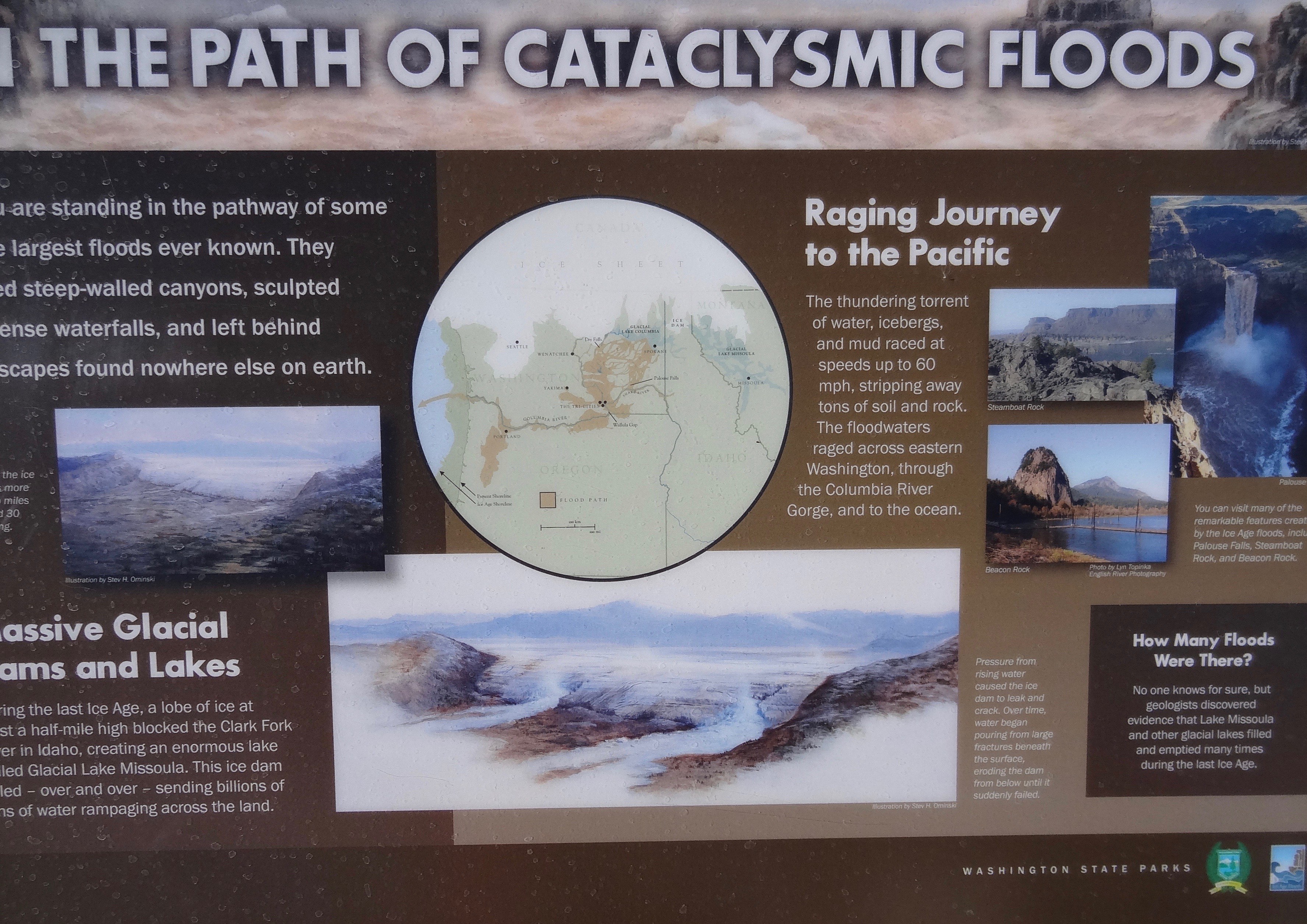
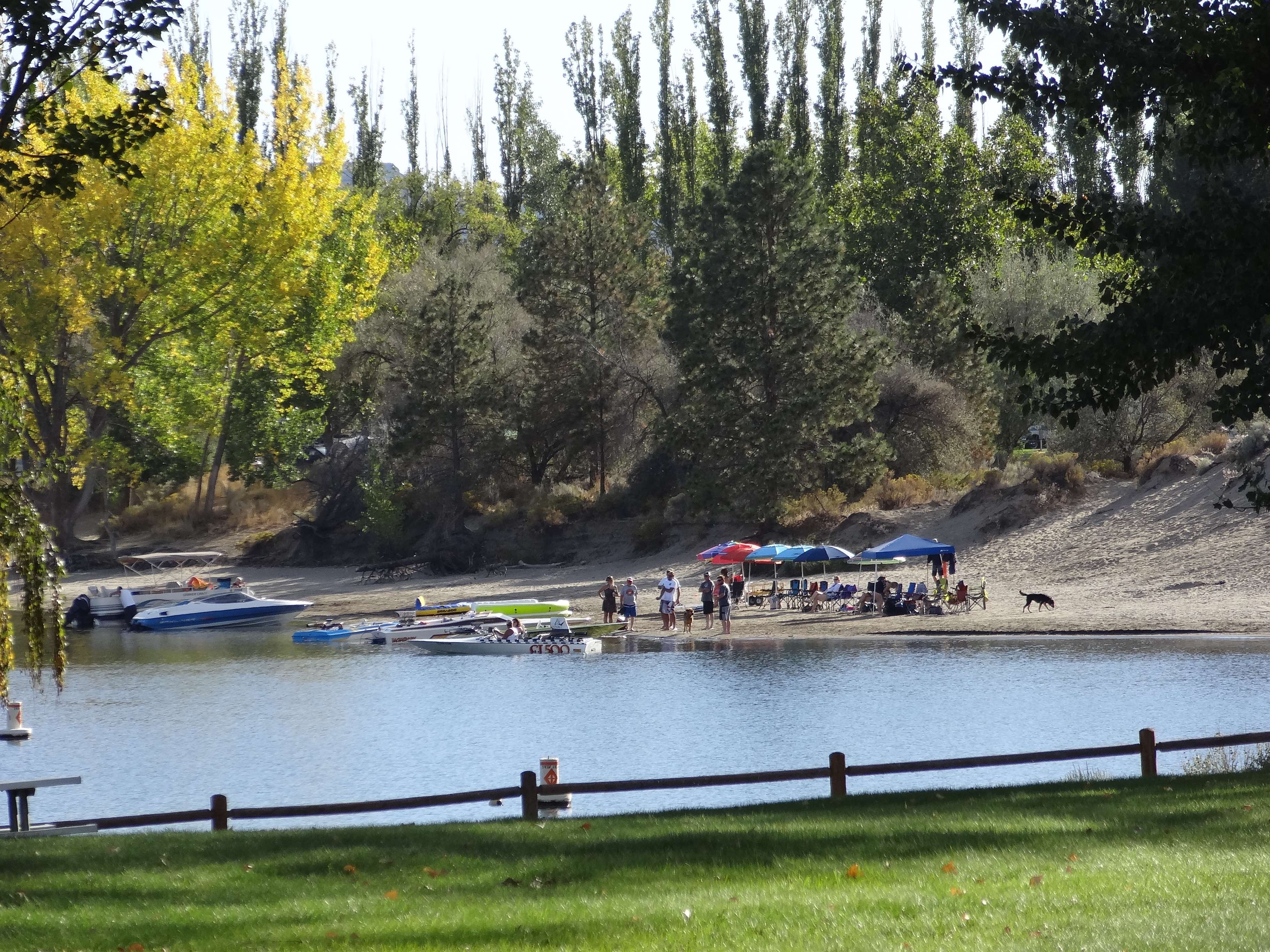
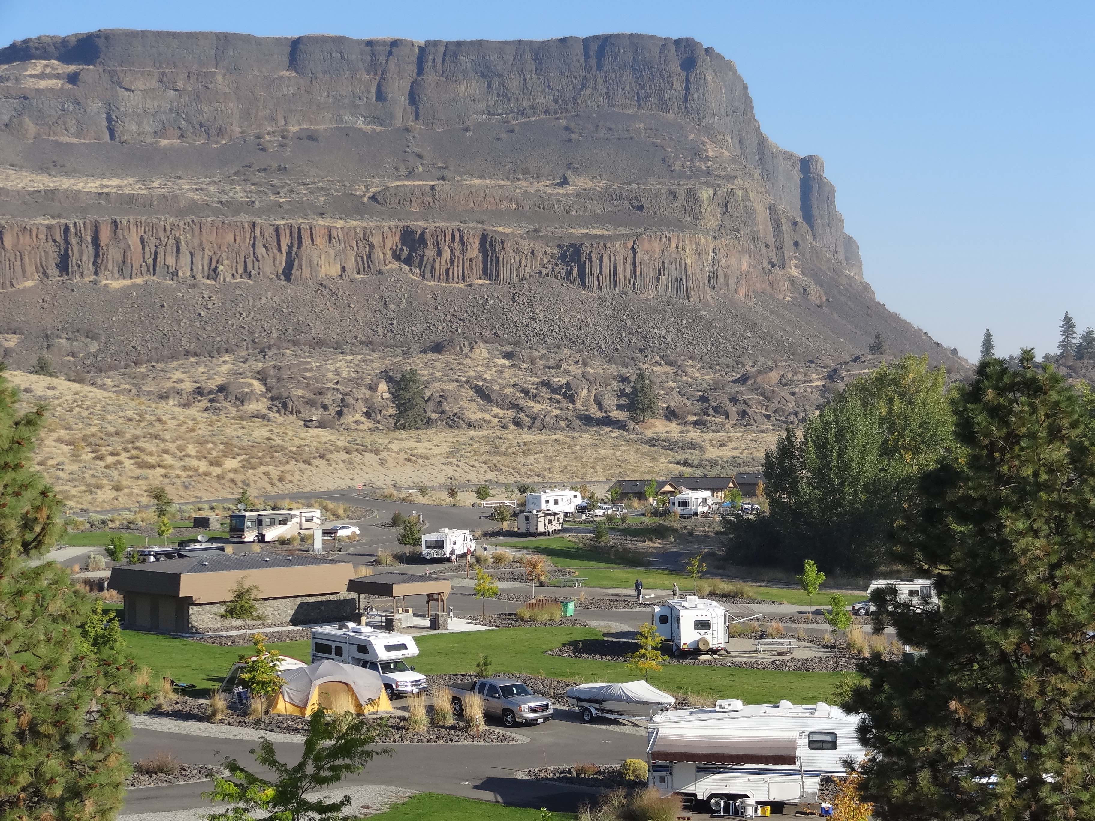
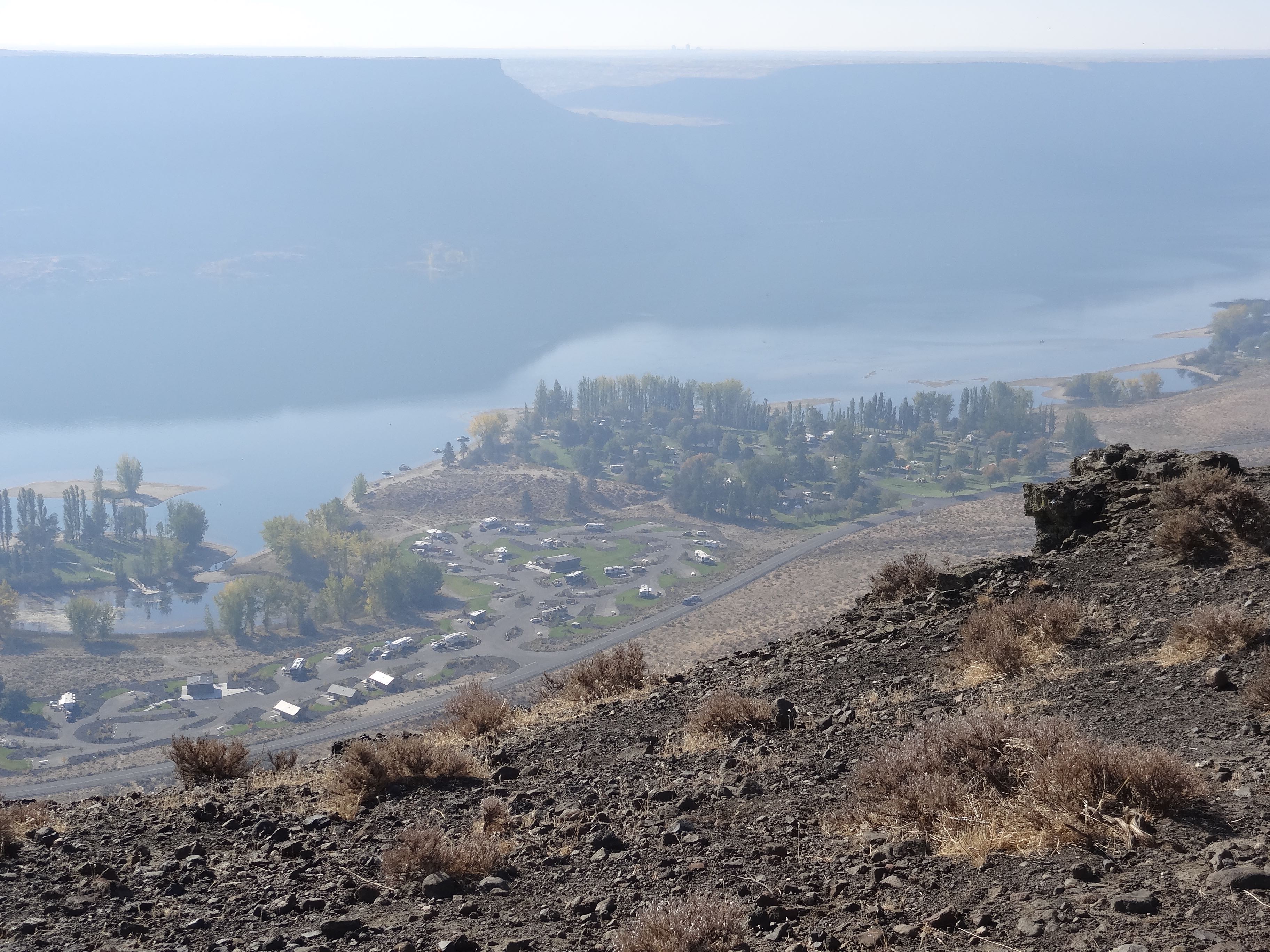
Steamboat Rock, in Grand Coulee, in central Washington, south of the Columbia River and Electric City and north of Moses Lake, shows evidence of being tormented and shaped by the flow of a once redirected Columbia River and massive ice age floods. Dry in historic memory, Grand Coulee is now wet, soaked by Banks Lake, a reservoir created by pumping from Lake Roosevelt behind Grand Coulee Dam, a major source for the million-acre Columbia Basin Project irrigation network.
Steamboat Rock State Park has 136 full-hookup campsites, a dock/fishing pier, sand beaches, boat launches, mountain bike trails, horse trails, prepared food, and a store. And best of all, for us, the park has 13 miles of hiking trails that scramble up to the top of the 600 acre, 800-foot-high basalt butte with views up and down Banks Lake.
In early September 2015 when we stopped at Steamboat in Further on our way to Banff, Washington was suffering its worst wildfire season in history. Multiple fires were burning near Lake Chelan, west of Grand Coulee, and the air at Steamboat was smoky, the view occluded.
Yvonne had made reservations through the Washington State Parks reservation system, smart (as usual) because the park was crowded with fishermen, families, a high performance boat group and well-behaved teenagers from Auburn Adventist Academy, a co-educational, Seventh-day Adventist, boarding high school near Seattle.
We weren’t towing a boat and didn’t have our kayaks so we didn’t get out on Banks Lake but would have enjoyed it. Steamboat looks like a wonderful place to boat, fish, kayak, and explore by water.
But what we could do was hike and after exploring the campground, we retrieved our hiking poles and a water bottle from Further and headed for the nearby Steamboat Rock trailhead.
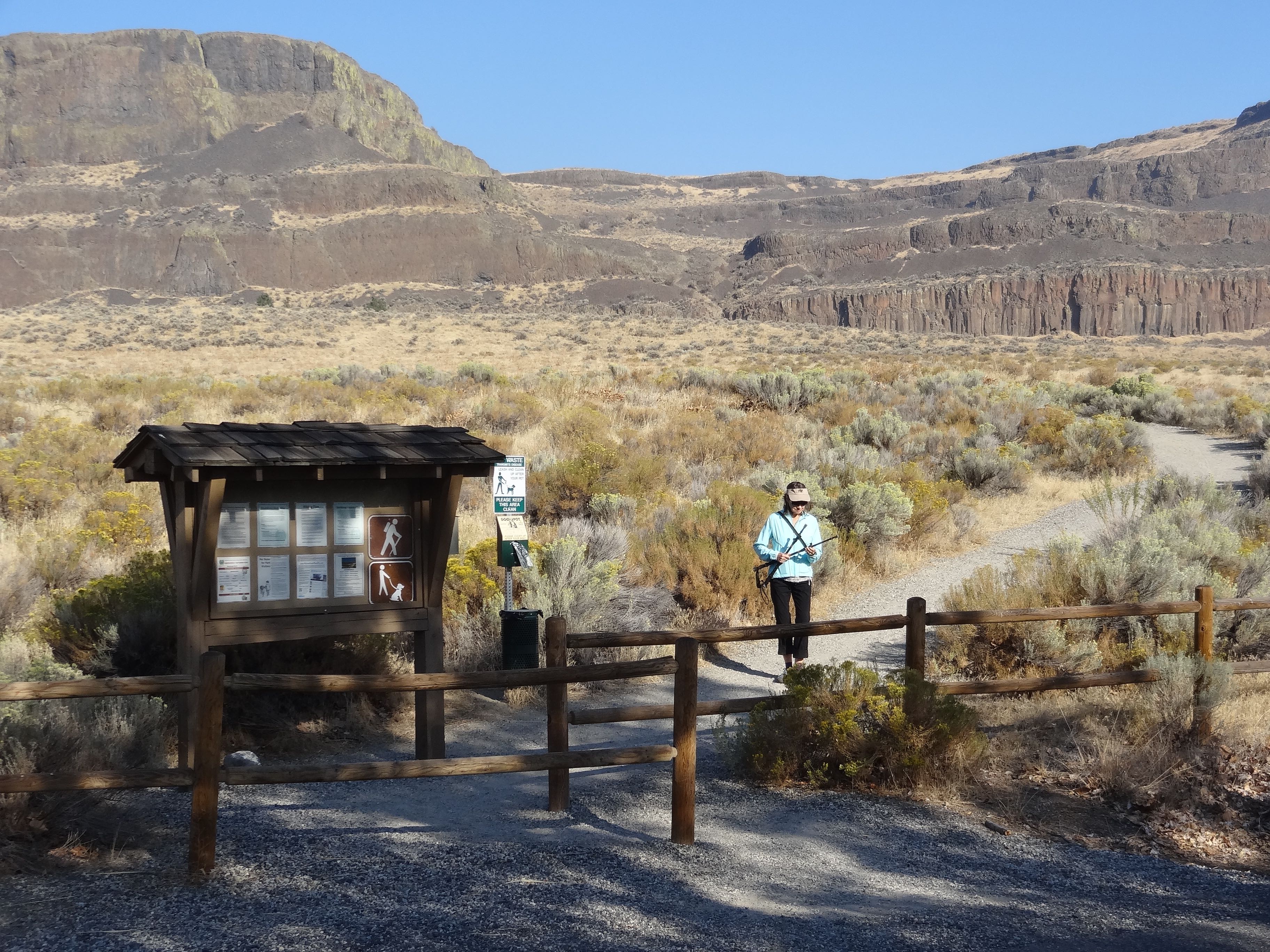
The first part of the trail was flat but when it hit the base of the Rock it headed steeply up hill, covered with good-sized rocks, not gravel, and going was slow.
Steamboat Rock, Grand Coulee, the Columbia River gorge, and other canyons in Central Washington are terraced, with a cliff-face topped by terrace topped by another cliff-face, the result of successive, massive floods, at different levels. Trails between terraces or to the top are often steep and sometimes problematic.
Even with wildfire smoke interfering, the view from the huge flat summit was wonderful, canyon walls to the east and west and lake, bays, islands, and rock formations to the north and south.
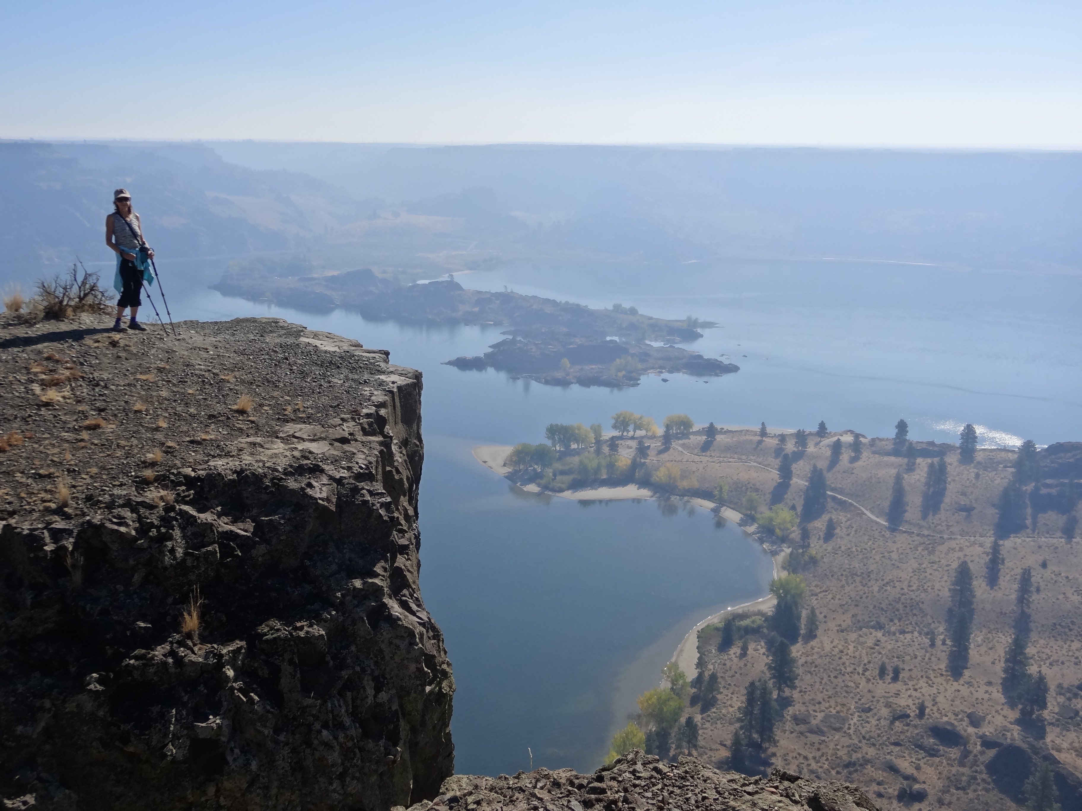
Because Steamboat Rock is relatively flat on top, it’s easy to walk, a route close to the edge has views that are particularly satisfying. Because it was late summer, dry and hot, we didn’t see wildflowers.
Thermals rise along the cliff edges and as we walked north ravens would suddenly rise from below floating on invisible air current and then sink back below out of sight.
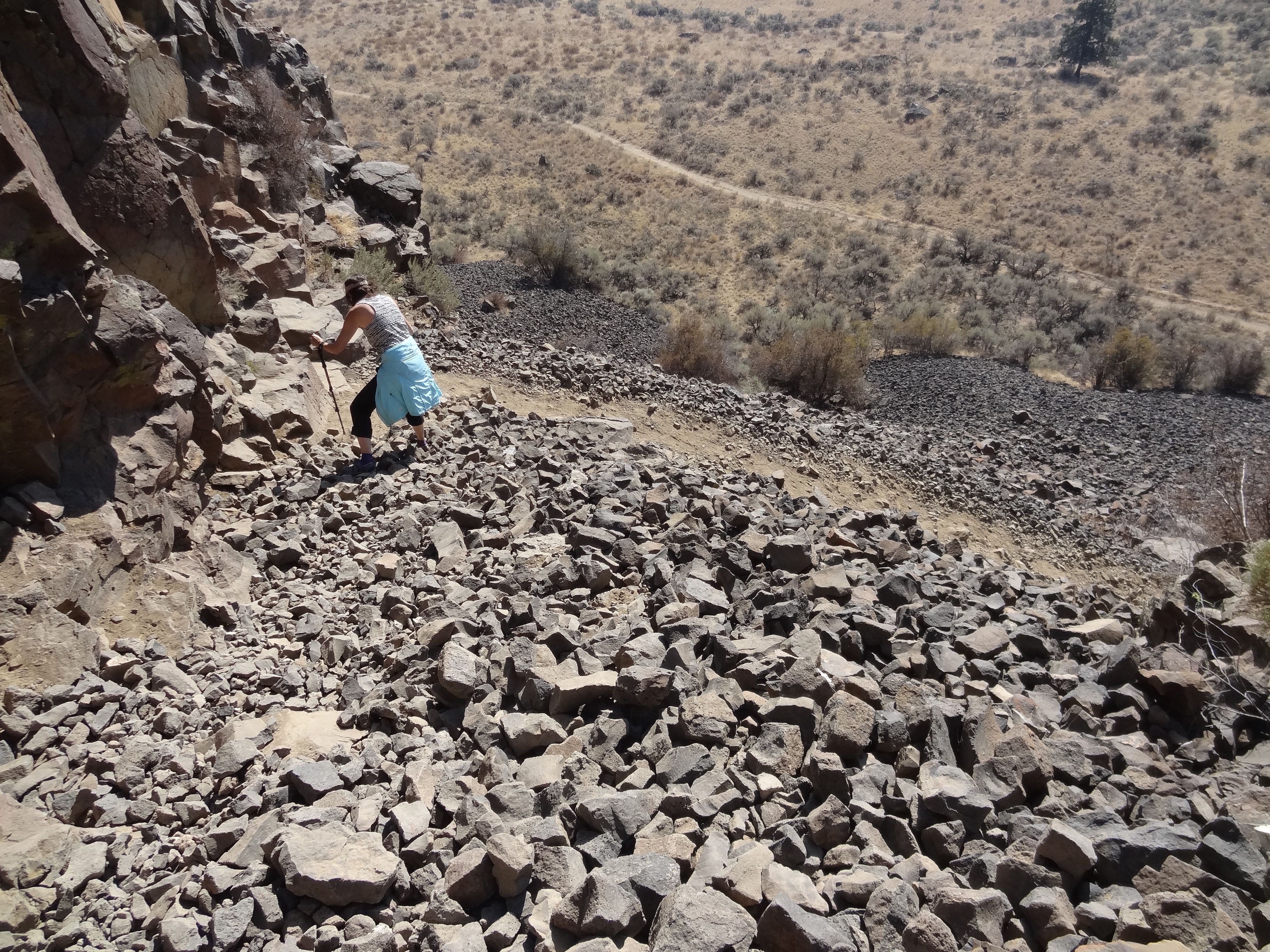
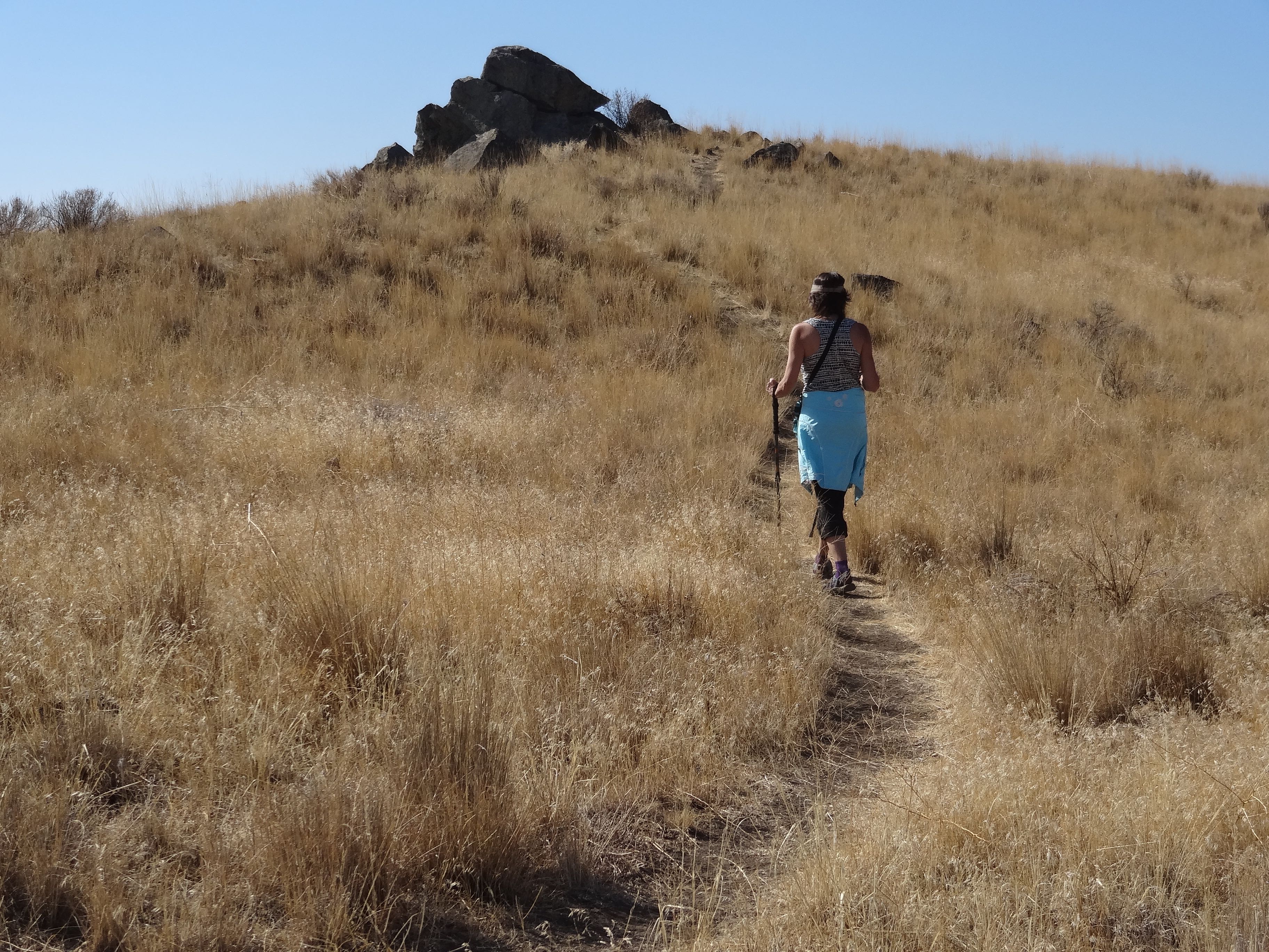
Some of the descent was a bit dicey because of talus on some steep sections of the trail.
Steamboat Rock is a great north-central Washington camping destination. Just north is Grand Coulee Dam, an engineering wonder of the world, more than four times wider than Hover Dam and generating more than three times the power.
If you plan to stay overnight make reservations.
© 2019 – 2020, johnashenhurst. All rights reserved.